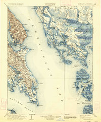
1906 Map of St. Marys
USGS Topo · Published 1934About this map
Chesapeake Bay dominates this early twentieth-century survey, revealing the intricate water-dependent life of the Eastern Shore and Southern Maryland before modern bridges unified the region. On the western shore, the deep-water harbor at Solomons and the long-established settlement at St. Marys anchor the peninsula, where the Potomac River meets the bay at Point Lookout. Across the water, the marshy archipelago of Dorchester County is captured in detail, showing fishing communities like Hoopersville and Applegarth on the Hooper Islands, many of which relied entirely on the bay for trade and travel.
Find a feature on this map
198 named features on this map. Tap any name to fly to it.
Don’t see what you’re looking for? This feature index may not catch every label — zoom into the map to look around manually.
Map Details
Editions of this 1906 St. Marys Map
4 editions found

Other maps of this area

1892 · Leonardtown
USGS Topo · 1:62,500

1892 · Drum Point
USGS Topo · 1:62,500

1892 · Prince Frederick
USGS Topo · 1:62,500

1892 · Piney Point
USGS Topo · 1:62,500

1893 · Sharps Island
USGS Topo · 1:62,500

1894 · Piney Point
USGS Topo · 1:62,500

1894 · Point Lookout
USGS Topo · 1:62,500

1895 · Prince Frederick
USGS Topo · 1:62,500

1895 · Leonardtown
USGS Topo · 1:62,500

1895 · Nomini
USGS Topo · 1:125,000