Loading...
Loading map...1904 Map of St. Michaels
USGS Topo · Published 1923About this map
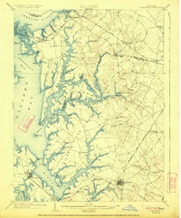
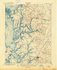
The intricate shoreline of the Wye River and Miles River defines this turn-of-the-century portrait of Talbot and Queen Anne counties. This 1902 survey, published in 1904 and reprinted in 1923, captures the region's heavy reliance on water and rail transport. Inland, the town of Easton serves as a major hub where the Delaware and Chesapeake R. R. and the Baltimore and Chesapeake Atlantic R. R. converge, while the Queen Anne's R. R. serves the northern reaches near Queenstown.
Find a feature on this map
87 named features on this map. Tap any name to fly to it.
Don’t see what you’re looking for? This feature index may not catch every label — zoom into the map to look around manually.
Map Details
Date Portrayed1904
Date Published1923
PublisherU.S. Geological Survey
Map TypeTopographic
Scale1:62,500
Physical Dimensions16.5 x 19.9 inches
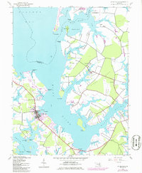
Editions of this 1904 St. Michaels Map
3 editions found

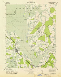
Historical Maps of Easton Through Time
3 maps found
Featured Locations
Source Details
SourceU.S. Geological Survey
CopyrightPublic Domain