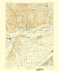
1985 Map of St. Paul
USGS Topo · Published 1985About this map
The confluence of the North Loup River and Middle Loup River near St Paul defines the geography of this central Nebraska landscape in the mid-1980s. The map illustrates a region deeply connected by its waterways and agricultural heritage, featuring historic settlements like the Danish-influenced Dannevirke and Nysted. Significant infrastructure is visible through the Burlington Northern and Union Pacific rail lines, which historically drove the development of towns such as Farwell (Posen) and Boelus (Howard City). To the west, the Sherman Reservoir provides a major focal point for water management and recreation. Landmarks like Happy Jack Peak and Mumpumpey Hill rise above the river valleys, offering a detailed perspective on the topography before the era of modern digital mapping.
Find a feature on this map
85 named features on this map. Tap any name to fly to it.
Don’t see what you’re looking for? This feature index may not catch every label — zoom into the map to look around manually.
Map Details
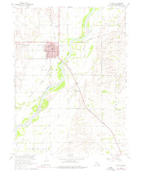
Editions of this 1985 St. Paul Map
2 editions found
Historical Maps of Central City Through Time
3 maps found