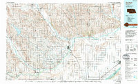
1985 Map of St. Paul
USGS Topo · Published 1994About this map
The confluence of Nebraska's river systems dominates this mid-1980s landscape, where the North Loup River, Middle Loup River, and South Loup River converge toward the Platte River valley. The map documents a well-defined agricultural and transportation grid, anchored by the Burlington Northern and Union Pacific railroads that connect rural hubs like St Paul and Central City. A notable cultural feature is the Old Indian Treaty Boundary, which cuts across the modern section lines in the northern reaches of the map.
Find a feature on this map
58 named features on this map. Tap any name to fly to it.
Don’t see what you’re looking for? This feature index may not catch every label — zoom into the map to look around manually.
Map Details
Editions of this 1985 St. Paul Map
2 editions found
Other maps of this area

1892 · Grand Island
USGS Topo · 1:62,500

1895 · Grand Island
USGS Topo · 1:62,500

1895 · Wood River
USGS Topo · 1:62,500

1896 · Kearney
USGS Topo · 1:125,000

1896 · Wood River
USGS Topo · 1:125,000

1896 · Stromsburg
USGS Topo · 1:125,000

1898 · York
USGS Topo · 1:125,000

1898 · Grand Island
USGS Topo · 1:125,000

1899 · Loup
USGS Topo · 1:125,000

1899 · St. Paul
USGS Topo · 1:125,000