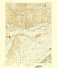
1899 Map of St. Paul
USGS Topo · Published 1939About this map
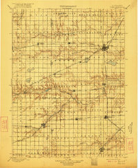
Loup River and its major tributaries define the topography of central Nebraska in this late nineteenth-century reconnaissance. The settlement of St. Paul serves as a regional hub at the confluence of the North Fork Loup River and the main channel, where the Burlington and Missouri River R. R. meets the Union Pacific R. R. (Ord Br.). Further southeast, Central City sits on the northern bank of the Platte River, a vital transportation corridor for the Union Pacific R. R. main line. This survey captures a specific agricultural transition, showing the early township grid system and naming distinct local districts such as Gage Valley, Midland, and Lone Tree. Curious landmarks like Four Room Blowout and Mumpumpey Hill provide evidence of the unique sandy soil features encountered by early surveyors and homesteaders in Howard and Merrick counties.
Find a feature on this map
63 named features on this map. Tap any name to fly to it.
Don’t see what you’re looking for? This feature index may not catch every label — zoom into the map to look around manually.
Map Details
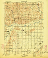
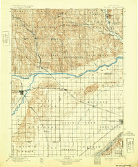
Editions of this 1899 St. Paul Map
4 editions found
Other maps of this area

1892 · Grand Island
USGS Topo · 1:62,500

1895 · Grand Island
USGS Topo · 1:62,500
1895 · Wood River
USGS Topo · 1:62,500

1896 · Wood River
USGS Topo · 1:125,000

1896 · Stromsburg
USGS Topo · 1:125,000

1898 · York
USGS Topo · 1:125,000

1898 · Grand Island
USGS Topo · 1:125,000

1899 · Loup
USGS Topo · 1:125,000

1899 · St. Paul
USGS Topo · 1:125,000
1899 · York
USGS Topo · 1:125,000