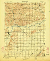
1899 Map of St. Paul
USGS Topo · Published 1913About this map
The Loup River and its multiple forks dominate this central Nebraska landscape during the late nineteenth century, providing a corridor for both settlement and transport. St. Paul serves as a primary hub where the Burlington and Missouri River R. R. and the Union Pacific R. R. converge, reflecting the region's dependence on rail for agricultural trade. The map documents numerous smaller rail-stop communities such as Wolbach, Cushing, and Palmer, which emerged as the prairie was surveyed into townships like Gage and Midland.
Find a feature on this map
73 named features on this map. Tap any name to fly to it.
Don’t see what you’re looking for? This feature index may not catch every label — zoom into the map to look around manually.
Map Details
Editions of this 1899 St. Paul Map
4 editions found
Other maps of this area

1892 · Grand Island
USGS Topo · 1:62,500

1895 · Grand Island
USGS Topo · 1:62,500

1895 · Wood River
USGS Topo · 1:62,500

1896 · Wood River
USGS Topo · 1:125,000

1896 · Stromsburg
USGS Topo · 1:125,000

1898 · York
USGS Topo · 1:125,000

1898 · Grand Island
USGS Topo · 1:125,000

1899 · Loup
USGS Topo · 1:125,000

1899 · St. Paul
USGS Topo · 1:125,000

1899 · York
USGS Topo · 1:125,000