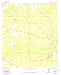
1970 Map of St. Tammany
USGS Topo · Published 1980About this map
Bayou Lacombe and its winding tributaries define this piney woods landscape of St. Tammany Parish, captured as the region balanced rural character with growing infrastructure in the early 1970s. The settlement of St Tammany and the nearby St Tammany Corner serve as focal points for local history, while the Crow Cem provides a specific point of interest for genealogical research near the bayou's banks.
Find a feature on this map
16 named features on this map. Tap any name to fly to it.
Don’t see what you’re looking for? This feature index may not catch every label — zoom into the map to look around manually.
Map Details
Editions of this 1970 St. Tammany Map
3 editions found
Other maps of this area

1935 · Slidell
USGS Topo · 1:62,500

1935 · Covington
USGS Topo · 1:62,500

1939 · Slidell
USGS Topo · 1:62,500

1939 · Covington
USGS Topo · 1:62,500

1942 · Waldheim
USGS Topo · 1:31,680

1942 · Talisheek
USGS Topo · 1:31,680

1942 · Walkiah Bluff
USGS Topo · 1:31,680

1950 · Slidell
USGS Topo · 1:62,500

1950 · Covington
USGS Topo · 1:62,500

1953 · Mobile
USGS Topo · 1:250,000