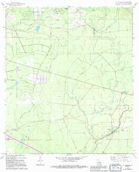
1970 Map of St. Tammany
USGS Topo · Published 1994About this map
Bayou Lacombe winds through the wetlands and pine forests of St. Tammany Parish, anchoring a landscape where rural settlements and emerging infrastructure intersect. This survey, based on 1969 photography with 1994 updates, documents the small communities of St Tammany and St Tammany Corner during a period of transition. The presence of a Landing Field, a Pumping Station, and multiple pipelines indicates the growing industrial and logistical importance of the region. Local history is preserved at the Crow Cem, while the natural drainage of the area is defined by Abita Cr, English Branch, and the dense Gum Swamp. The map also highlights numerous private roads and property boundaries, reflecting the land use patterns before more intensive suburban development reached this part of the parish.
Find a feature on this map
16 named features on this map. Tap any name to fly to it.
Don’t see what you’re looking for? This feature index may not catch every label — zoom into the map to look around manually.
Map Details
Editions of this 1970 St. Tammany Map
3 editions found
Other maps of this area

1935 · Slidell
USGS Topo · 1:62,500

1935 · Covington
USGS Topo · 1:62,500

1939 · Slidell
USGS Topo · 1:62,500

1939 · Covington
USGS Topo · 1:62,500

1942 · Waldheim
USGS Topo · 1:31,680

1942 · Talisheek
USGS Topo · 1:31,680

1942 · Walkiah Bluff
USGS Topo · 1:31,680

1950 · Slidell
USGS Topo · 1:62,500

1950 · Covington
USGS Topo · 1:62,500

1953 · Mobile
USGS Topo · 1:250,000