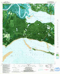
1981 Map of St. Teresa
USGS Topo · Published 1992About this map
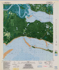
St. James Island dominates this coastal survey, where the terrestrial landscape of dense hammocks and small interior lakes meets the intricate waters of the Gulf of Mexico. The settlement of St. Teresa sits perched along the northern shore of Alligator Harbor, a narrow body of water protected by the Mouth of Bay Bar and Peninsula Point. The northern portion of the map is defined by the confluence of the Ochlockonee River and the Shell River, bordering the protected lands of Ochlockonee River State Park and the St. Marks National Wildlife Refuge.
Find a feature on this map
40 named features on this map. Tap any name to fly to it.
Don’t see what you’re looking for? This feature index may not catch every label — zoom into the map to look around manually.
Map Details
Editions of this 1981 St. Teresa Map
2 editions found
Other maps of this area

1940 · Arran
USGS Topo · 1:62,500

1943 · Arran
USGS Topo · 1:62,500

1943 · Dog Island
USGS Topo · 1:31,680

1943 · St. Teresa Beach
USGS Topo · 1:24,000

1943 · Lighthouse Point
USGS Topo · 1:24,000

1945 · Lighthouse Point
USGS Topo · 1:31,680

1945 · Mc Intyre
USGS Topo · 1:31,680

1945 · St Teresa
USGS Topo · 1:31,680

1945 · Sanborn
USGS Topo · 1:31,680

1949 · Apalachicola
USGS Topo · 1:250,000