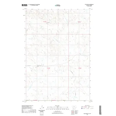
2020 Map of Stack Rocks
USGS Topo · Published 2020About this map
Stack Rocks and the distinctive Rock Wall formation anchor this section of the Montana-Wyoming border in Carter County. The landscape is defined by the drainage basins of several waterways, including the E Fork Little Powder River and Thompson Creek. This 2020 survey illustrates a sparsely populated ranching environment where travel is governed by high-ground routes like Alzada Ridge Rd and Ridge Rd. The intricate network of intermittent streams, such as Coal Creek and Short Creek, highlights the importance of water management and topography in this corner of the High Plains. Land divisions are clearly marked through township and range boundaries, including t8s r55e and t58n r67w, providing a precise framework for understanding land ownership and historical boundaries along the state line.
Find a feature on this map
19 named features on this map. Tap any name to fly to it.
Don’t see what you’re looking for? This feature index may not catch every label — zoom into the map to look around manually.
Map Details
Editions of this 2020 Stack Rocks Map
This is the sole edition of this map. No revisions or reprints were ever made.
Other maps of this area

1905 · Devils Tower
USGS Topo · 1:125,000

1954 · Ekalaka
USGS Topo · 1:250,000

1954 · Gillette
USGS Topo · 1:250,000

1955 · Gillette
USGS Topo · 1:250,000

1956 · Ekalaka
USGS Topo · 1:250,000

1957 · Cedar Ridge
USGS Topo · 1:62,500

1958 · Gillette
USGS Topo · 1:250,000

1958 · Ekalaka
USGS Topo · 1:250,000

1962 · Gillette
USGS Topo · 1:250,000

1965 · Ekalaka
USGS Topo · 1:250,000