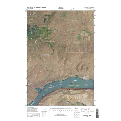
2014 Map of Stacker Butte
USGS Topo · Published 2014About this map
The Columbia River carves a deep path between Washington and Oregon on this modern survey, marking the jurisdictional line between Klickitat and Wasco Counties. On the northern shore, the steep slopes of Stacker Butte and the Columbia Hills overlook the water, with Stacker Canyon and Swale Canyon cutting through the uplands. Near the riverbanks, distinct landmarks like Horsethief Butte and Horsethief Lake sit alongside the settlement of Avery. Navigation aids including the Memaloose Island Light and Fivemile Rapids Light highlight the river's historical importance as a maritime corridor.
Find a feature on this map
46 named features on this map. Tap any name to fly to it.
Don’t see what you’re looking for? This feature index may not catch every label — zoom into the map to look around manually.
Map Details
Editions of this 2014 Stacker Butte Map
This is the sole edition of this map. No revisions or reprints were ever made.
Other maps of this area

1934 · The Dalles
USGS Topo · 1:125,000

1953 · The Dalles
USGS Topo · 1:250,000

1956 · The Dalles
USGS Topo · 1:250,000

1957 · The Dalles
USGS Topo · 1:250,000

1957 · Klickitat
USGS Topo · 1:62,500

1957 · Goldendale
USGS Topo · 1:62,500

1957 · The Dalles
USGS Topo · 1:62,500

1957 · Wishram
USGS Topo · 1:62,500

1974 · Stacker Butte
USGS Topo · 1:24,000

1974 · The Dalles North
USGS Topo · 1:24,000