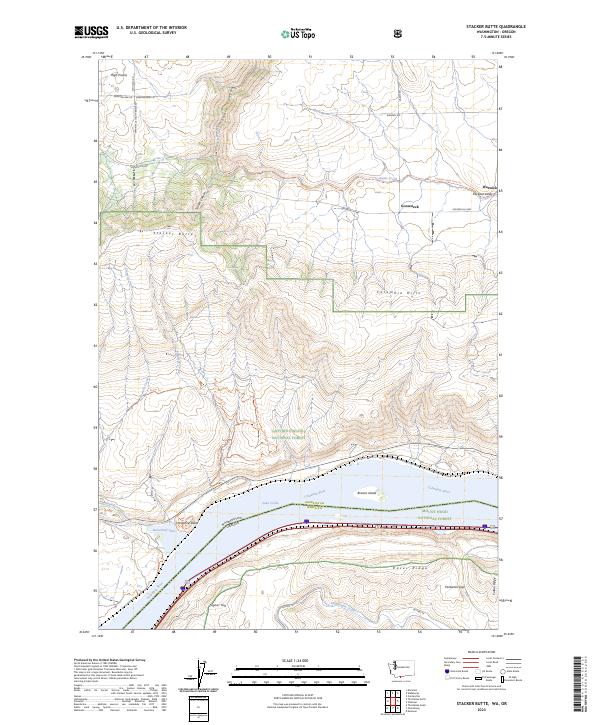
2023 Map of Stacker Butte
USGS Topo · Published 2023About this map
Stacker Butte rises as the prominent high point of the Columbia Hills, overlooking a dramatic stretch of the Columbia River where the borders of Washington and Oregon meet. This 2023 survey details the geographic complexity of Klickitat Co and Wasco Co, showing the transition from the high agricultural plateau of High Prairie down to the river’s edge. The landscape is defined by deep incisions like Swale Canyon and Stacker Canyon, which provide natural corridors through the hills. Along the river, the pool of Lake Celilo dominates the valley floor, featuring Browns Island and the recreation areas surrounding Horsethief Lake. Transportation networks are heavily represented by the Centerville Hwy and the historic Military Road Trl, while the Klickitat State Park Trl follows the winding path of Swale Creek toward the small settlement of Warwick. Local landmarks like Horsethief Butte and Signal Hill serve as significant navigational waypoints for those exploring the Gifford Pinchot National Forest and Mount Hood National Forest boundaries.
Find a feature on this map
46 named features on this map. Tap any name to fly to it.
Don’t see what you’re looking for? This feature index may not catch every label — zoom into the map to look around manually.
Map Details
Editions of this 2023 Stacker Butte Map
This is the sole edition of this map. No revisions or reprints were ever made.
Other maps of this area

1934 · The Dalles
USGS Topo · 1:125,000

1953 · The Dalles
USGS Topo · 1:250,000

1956 · The Dalles
USGS Topo · 1:250,000

1957 · The Dalles
USGS Topo · 1:250,000

1957 · Klickitat
USGS Topo · 1:62,500

1957 · Goldendale
USGS Topo · 1:62,500

1957 · The Dalles
USGS Topo · 1:62,500

1957 · Wishram
USGS Topo · 1:62,500

1974 · Stacker Butte
USGS Topo · 1:24,000

1974 · The Dalles North
USGS Topo · 1:24,000