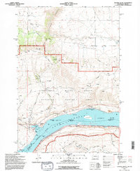
1994 Map of Stacker Butte
USGS Topo · Published 1995About this map
The Columbia River corridor serves as the central focal point of this 1994 revision, where the river's character is defined by the expansive waters of Lake Celilo behind the Dalles Dam. The map highlights the complex topography of the Columbia River Gorge National Scenic Area, rising from the riverbanks to the summit of Stacker Butte and the rolling terrain of the Gooseneck Hills. Along the shoreline, historical and recreational sites are well-documented, including Horsethief Lake State Park and the distinct volcanic form of Horsethief Butte. Marine navigation aids such as the Fivemile Rapids Light and Mile 7 Light track the river's channel past Memaloose Island and Browns Island. Further inland, the map captures the rural character of High Prairie and the agricultural transition toward Seufert, where several named springs and seasonal drainages like Swale Canyon carve through the basalt plateaus.
Find a feature on this map
47 named features on this map. Tap any name to fly to it.
Don’t see what you’re looking for? This feature index may not catch every label — zoom into the map to look around manually.
Map Details
Editions of this 1994 Stacker Butte Map
This is the sole edition of this map. No revisions or reprints were ever made.
Other maps of this area

1934 · The Dalles
USGS Topo · 1:125,000

1953 · The Dalles
USGS Topo · 1:250,000

1956 · The Dalles
USGS Topo · 1:250,000

1957 · The Dalles
USGS Topo · 1:250,000

1957 · Klickitat
USGS Topo · 1:62,500

1957 · Goldendale
USGS Topo · 1:62,500

1957 · The Dalles
USGS Topo · 1:62,500

1957 · Wishram
USGS Topo · 1:62,500

1974 · Stacker Butte
USGS Topo · 1:24,000

1974 · The Dalles North
USGS Topo · 1:24,000