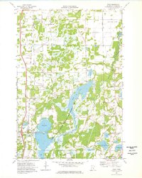
1974 Map of Stacy
USGS Topo · Published 1976About this map
Carlos Avery State Wildlife Management Area dominates the central landscape of this Chisago County survey, featuring the extensive North Pool and a network of wetlands connected by the Sunrise River. The settlement of Stacy serves as a local hub along the Burlington Northern railroad, accompanied by the Stacy Cem and Faith Ch. The map captures a transitional rural environment where agricultural land meets managed conservation areas.
Find a feature on this map
31 named features on this map. Tap any name to fly to it.
Don’t see what you’re looking for? This feature index may not catch every label — zoom into the map to look around manually.
Map Details
Editions of this 1974 Stacy Map
This is the sole edition of this map. No revisions or reprints were ever made.
Other maps of this area

1950 · Rush City
USGS Topo · 1:48,000

1953 · Stillwater
USGS Topo · 1:250,000

1955 · Rush City
USGS Topo · 1:62,500

1955 · Forest Lake
USGS Topo · 1:62,500

1955 · Isanti
USGS Topo · 1:62,500

1955 · Stillwater
USGS Topo · 1:250,000

1958 · Stillwater
USGS Topo · 1:250,000

1961 · Cambridge
USGS Topo · 1:62,500

1965 · Stillwater
USGS Topo · 1:250,000
1974 · Scandia
USGS Topo · 1:24,000