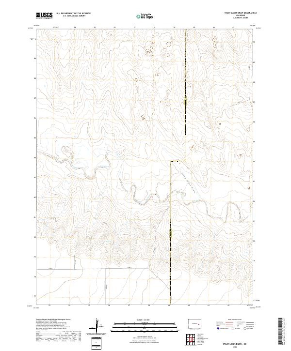
2022 Map of Stacy Lakes Draw
USGS Topo · Published 2022About this map
Stacy Lakes Draw winds across this section of the Eastern Colorado plains, defining a landscape marked by intermittent water and the quiet intersections of the rural road grid. The presence of Stacy Spring and the meandering path of Rush Creek illustrate the vital importance of water sources in this arid region. The boundary between Lincoln Co and Cheyenne Co runs vertically through the center of the survey, where simple county roads like Co RD O and Co RD 49 maintain the only connection between isolated sections of land. The map reveals the precise township and range structure, including t15s r52w and t16s r51w, that governs the ranching and agricultural life of the high plains.
Find a feature on this map
15 named features on this map. Tap any name to fly to it.
Don’t see what you’re looking for? This feature index may not catch every label — zoom into the map to look around manually.
Map Details
Editions of this 2022 Stacy Lakes Draw Map
This is the sole edition of this map. No revisions or reprints were ever made.
Other maps of this area

1891 · Arroyo
USGS Topo · 1:125,000

1893 · Arroyo
USGS Topo · 1:125,000

1954 · Lamar
USGS Topo · 1:250,000

1958 · Lamar
USGS Topo · 1:250,000

1978 · Galatea NE
USGS Topo · 1:24,000

1978 · Aroya
USGS Topo · 1:24,000

1978 · Barrel Springs Draw
USGS Topo · 1:24,000
1978 · Galatea SW
USGS Topo · 1:24,000

1978 · Rock Basin
USGS Topo · 1:24,000

1978 · Stacy Lakes Draw
USGS Topo · 1:24,000