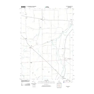
2010 Map of Stafford
USGS Topo · Published 2010About this map
Stafford and its neighboring hamlets sit within a landscape of rolling agricultural land and winding creek beds in Genesee County. The topography is defined by several prominent rises, including Temperance Hill in the north and the cluster of Skunk Hill, Scarf Hill, and Burks Hill to the south. Oatka Creek carves a path through the eastern portion of the quadrangle, passing near the curiously named Jug City Cemetery and the settlement of Roanoke. The area's long-established rural character is evident in the numerous burial grounds marking the landscape, such as the Fargo Road Pioneer Cemetery and Transit Cemetery.
Find a feature on this map
72 named features on this map. Tap any name to fly to it.
Don’t see what you’re looking for? This feature index may not catch every label — zoom into the map to look around manually.
Map Details
Editions of this 2010 Stafford Map
This is the sole edition of this map. No revisions or reprints were ever made.
Other maps of this area

1897 · Albion
USGS Topo · 1:62,500

1899 · Brockport
USGS Topo · 1:62,500

1904 · Batavia
USGS Topo · 1:62,500

1904 · Caledonia
USGS Topo · 1:62,500

1935 · Churchville
USGS Topo · 1:24,000

1944 · Churchville
USGS Topo · 1:31,680

1944 · Byron
USGS Topo · 1:31,680

1944 · Stafford
USGS Topo · 1:31,680
1944 · Le Roy
USGS Topo · 1:31,680
1944 · Leicester
USGS Topo · 1:31,680