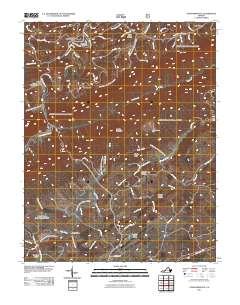
2011 Map of Staffordsville
USGS Topo · Published 2011About this map
Staffordsville and the surrounding high country of Giles County are defined by a complex network of ridges and watercourses, including the prominent Cloyds Mountain and Shuffle Ridge. The landscape is a patchwork of small communities and family burial grounds, such as the Shannon-King Cemetery near Poplar Hill and the Anderson-Vickers Cemetery further south. These local landmarks offer valuable data for genealogical research into the region's established families.
Find a feature on this map
66 named features on this map. Tap any name to fly to it.
Don’t see what you’re looking for? This feature index may not catch every label — zoom into the map to look around manually.
Map Details
Editions of this 2011 Staffordsville Map
This is the sole edition of this map. No revisions or reprints were ever made.
Other maps of this area

1890 · Dublin
USGS Topo · 1:125,000

1891 · Dublin
USGS Topo · 1:125,000

1913 · Peterstown
USGS Topo · 1:48,000

1916 · Peterstown
USGS Topo · 1:62,500

1923 · Pearisburg
USGS Topo · 1:62,500

1925 · Peterstown
USGS Topo · 1:62,500

1932 · Peterstown
USGS Topo · 1:48,000

1932 · Pearisburg
USGS Topo · 1:48,000

1934 · Pulaski
USGS Topo · 1:48,000

1937 · Pearisburg
USGS Topo · 1:62,500