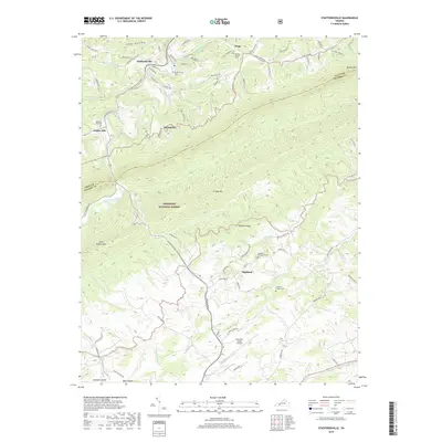
2019 Map of Staffordsville
USGS Topo · Published 2019About this map
Staffordsville and the surrounding highlands of Giles and Pulaski Counties are defined by the prominent ridgelines of Walker Mtn and Cloyds Mtn. This modern survey reveals a landscape where traditional Appalachian settlements like Trigg, Poplar Hill, and Highland persist alongside contemporary infrastructure like the New River Valley Airport. The terrain is deeply incised by numerous waterways, including Walker Creek and its many tributaries such as Wabash Creek and Back Cr, which have historically dictated the placement of roads like the Pulaski-Giles Tpke. Large portions of the central area are preserved within the Jefferson National Forest, maintaining the wooded character of Shuffle Ridge. For those tracing local families, several small burial grounds are documented, including the Staffordsville Cem and Highland Emmanuel Cem, providing valuable touchstones for genealogical research in this part of southwest Virginia.
Find a feature on this map
87 named features on this map. Tap any name to fly to it.
Don’t see what you’re looking for? This feature index may not catch every label — zoom into the map to look around manually.
Map Details
Editions of this 2019 Staffordsville Map
This is the sole edition of this map. No revisions or reprints were ever made.
Other maps of this area

1890 · Dublin
USGS Topo · 1:125,000

1891 · Dublin
USGS Topo · 1:125,000

1913 · Peterstown
USGS Topo · 1:48,000

1916 · Peterstown
USGS Topo · 1:62,500

1923 · Pearisburg
USGS Topo · 1:62,500

1925 · Peterstown
USGS Topo · 1:62,500

1932 · Peterstown
USGS Topo · 1:48,000

1932 · Pearisburg
USGS Topo · 1:48,000

1934 · Pulaski
USGS Topo · 1:48,000

1937 · Pearisburg
USGS Topo · 1:62,500