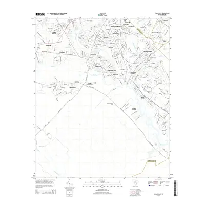
2014 Map of Stallsville
USGS Topo · Published 2014About this map
The Ashley River meanders through this portion of the Lowcountry, serving as the historical backbone for the suburban expansion of Summerville. This area shows a dense network of neighborhoods such as Stallsville, Lincolnville, and Ashborough, where modern residential developments overlap with older geographic markers. Genealogists can identify several local burial grounds, including Salters Cem, Cooke Cem, and the Summerville Cem near the Sawmill Branch. The landscape transitions from the concentrated residential blocks of Ladson and Chandler Lakes in the northeast toward more wooded stretches near Greggs Landing and the Summerville Lookout Tower to the south. Significant local transit corridors like Dorchester Rd and Ashley River Rd define the commute patterns through Cooke Crossroads and Dorchester Crossing, reflecting the rapid mid-2010s growth across the Dorchester and Charleston county line.
Find a feature on this map
87 named features on this map. Tap any name to fly to it.
Don’t see what you’re looking for? This feature index may not catch every label — zoom into the map to look around manually.
Map Details
Editions of this 2014 Stallsville Map
This is the sole edition of this map. No revisions or reprints were ever made.
Other maps of this area

1918 · Cottageville
USGS Topo · 1:62,500

1919 · Ladson
USGS Topo · 1:21,120

1919 · Johns Island
USGS Topo · 1:21,120

1919 · Summerville
USGS Topo · 1:48,000

1919 · Ridgeville
USGS Topo · 1:48,000

1920 · Ravenels
USGS Topo · 1:62,500

1920 · Ridgeville
USGS Topo · 1:62,500

1920 · Summerville
USGS Topo · 1:62,500

1943 · Cottageville
USGS Topo · 1:62,500

1943 · Ladson
USGS Topo · 1:24,000