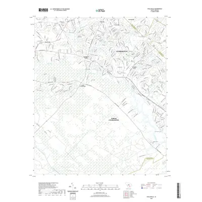
2020 Map of Stallsville
USGS Topo · Published 2020About this map
Middleton Place sits along the southern curves of the Ashley River, anchoring a landscape defined by the convergence of Dorchester and Charleston counties. This 2020 map documents the transition from the densely suburban neighborhoods of Summerville and Tranquil Acres to the expansive wetlands of Round Savanna and Bear Swamp. The settlement patterns here reflect modern growth interspersed with older landmarks like Bacon Bridge and Cooke Crossroads.
Find a feature on this map
259 named features on this map. Tap any name to fly to it.
Don’t see what you’re looking for? This feature index may not catch every label — zoom into the map to look around manually.
Map Details
Editions of this 2020 Stallsville Map
This is the sole edition of this map. No revisions or reprints were ever made.
Other maps of this area

1918 · Cottageville
USGS Topo · 1:62,500

1919 · Ladson
USGS Topo · 1:21,120

1919 · Johns Island
USGS Topo · 1:21,120

1919 · Summerville
USGS Topo · 1:48,000

1919 · Ridgeville
USGS Topo · 1:48,000

1920 · Ravenels
USGS Topo · 1:62,500

1920 · Ridgeville
USGS Topo · 1:62,500

1920 · Summerville
USGS Topo · 1:62,500

1943 · Cottageville
USGS Topo · 1:62,500

1943 · Ladson
USGS Topo · 1:24,000