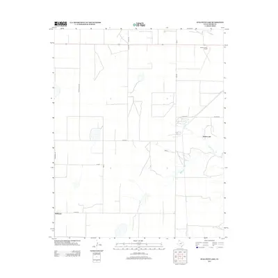
2012 Map of Stallwitz Lake
USGS Topo · Published 2012About this map
The settlement of Middlewell anchors the southwestern corner of this Moore County landscape, situated where Co Hwy-722 meets Middlewell Rd. This Texas Panhandle terrain is characterized by a sparse, grid-like road network and scattered drainage features, most notably the namesake Stallwitz Lake in the eastern section and the upper reaches of N Big Blue Cr. The northern edge is dominated by a major east-west thoroughfare, while the Moore County Airport sits just below this line, marking a point of regional connectivity. Local navigation is defined by family-named routes such as S Buddy Kline Rd and S Hunt Rd, reflecting the rural agricultural character of the region. The map provides a clear record of land division and water resources in this part of the Llano Estacado.
Find a feature on this map
17 named features on this map. Tap any name to fly to it.
Don’t see what you’re looking for? This feature index may not catch every label — zoom into the map to look around manually.
Map Details
Editions of this 2012 Stallwitz Lake Map
This is the sole edition of this map. No revisions or reprints were ever made.
Other maps of this area

1936 · Fourways
USGS Topo · 1:62,500

1953 · Masterson
USGS Topo · 1:24,000

1954 · Tucumcari
USGS Topo · 1:250,000

1954 · Amarillo
USGS Topo · 1:250,000

1958 · Amarillo
USGS Topo · 1:250,000

1958 · Tucumcari
USGS Topo · 1:250,000

1963 · Bird Ranch Store
USGS Topo · 1:24,000

1963 · Stallwitz Lake
USGS Topo · 1:24,000

1963 · Moran Ranch
USGS Topo · 1:24,000

1965 · Dumas South
USGS Topo · 1:24,000