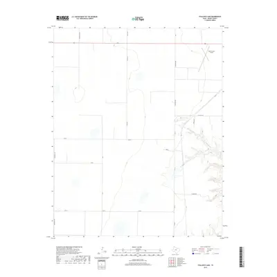
2019 Map of Stallwitz Lake
USGS Topo · Published 2019About this map
Moore County Airport sits in the northeastern corner of this Moore County landscape, serving as a primary navigational landmark for the region. The map reveals a strictly gridded agricultural and ranching infrastructure characteristic of the Texas Panhandle, dominated by a network of sectional roads like Middlewell Rd, W Rd R, and Rd 5. These straight thoroughfares contrast sharply with the drainage patterns of N-Big-Blue Cr, which carves a series of branching draws through the eastern portion of the quadrangle. Transport is anchored by the corridor of US Highway 87 and state-maintained routes such as Fm 722. Named local arteries like Stallwitz Rd and Rainbow Rd reflect the family and geographical identifiers essential for locating property and tracing local land use in this open ranching country.
Find a feature on this map
18 named features on this map. Tap any name to fly to it.
Don’t see what you’re looking for? This feature index may not catch every label — zoom into the map to look around manually.
Map Details
Editions of this 2019 Stallwitz Lake Map
This is the sole edition of this map. No revisions or reprints were ever made.
Other maps of this area

1936 · Fourways
USGS Topo · 1:62,500

1953 · Masterson
USGS Topo · 1:24,000

1954 · Tucumcari
USGS Topo · 1:250,000

1954 · Amarillo
USGS Topo · 1:250,000

1958 · Amarillo
USGS Topo · 1:250,000

1958 · Tucumcari
USGS Topo · 1:250,000

1963 · Bird Ranch Store
USGS Topo · 1:24,000

1963 · Stallwitz Lake
USGS Topo · 1:24,000

1963 · Moran Ranch
USGS Topo · 1:24,000

1965 · Dumas South
USGS Topo · 1:24,000