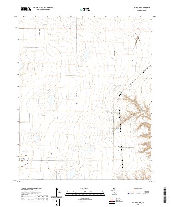
2022 Map of Stallwitz Lake
USGS Topo · Published 2022About this map
The high plains of Moore County come into focus through a network of rural roads and aviation infrastructure. The Moore County Airport occupies the northeastern corner of this landscape, positioned near the intersection of Highway 87 and Ranch Rd 2589. This modern survey illustrates the expansive agricultural and ranching layout characteristic of the Texas Panhandle, where long, straight thoroughfares like S Buddy Kline Rd and N Hunt Rd divide the terrain into massive blocks. In the east, the flat topography gives way to the more complex drainage of the N Big Blue Cr, where the land begins to break into draws and canyons. Smaller local routes such as Stallwitz Rd and Rainbow Rd connect the scattered homesteads and industrial points across this wide-open geography.
Find a feature on this map
18 named features on this map. Tap any name to fly to it.
Don’t see what you’re looking for? This feature index may not catch every label — zoom into the map to look around manually.
Map Details
Editions of this 2022 Stallwitz Lake Map
This is the sole edition of this map. No revisions or reprints were ever made.
Other maps of this area

1936 · Fourways
USGS Topo · 1:62,500

1953 · Masterson
USGS Topo · 1:24,000

1954 · Tucumcari
USGS Topo · 1:250,000

1954 · Amarillo
USGS Topo · 1:250,000

1958 · Amarillo
USGS Topo · 1:250,000

1958 · Tucumcari
USGS Topo · 1:250,000

1963 · Bird Ranch Store
USGS Topo · 1:24,000

1963 · Stallwitz Lake
USGS Topo · 1:24,000

1963 · Moran Ranch
USGS Topo · 1:24,000

1965 · Dumas South
USGS Topo · 1:24,000