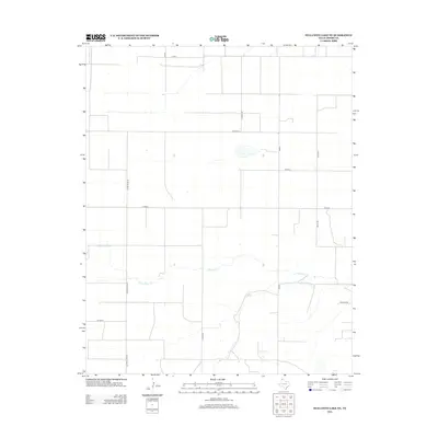
2012 Map of Stallwitz Lake NE
USGS Topo · Published 2012About this map
S Palo Duro Cr winds through the southern portion of this Moore County landscape, serving as the primary drainage for a region defined by an expansive grid of agricultural and ranching access roads. In the early 21st century, this section of the Texas Panhandle remained sparsely populated, characterized by large-scale land divisions and corridors like Buddy Kline Rd and Starkey Rd. The absence of dense town sites highlights the area's rural nature, where transportation routes such as Miles Rd and N Hunt Rd connect distant ranch headquarters and homesteads across the open plains. Small water features and intermittent drainages branching from the main creek indicate the subtle topography that shapes local grazing and farming practices in this high-plains environment.
Find a feature on this map
14 named features on this map. Tap any name to fly to it.
Don’t see what you’re looking for? This feature index may not catch every label — zoom into the map to look around manually.
Map Details
Editions of this 2012 Stallwitz Lake NE Map
This is the sole edition of this map. No revisions or reprints were ever made.
Other maps of this area

1954 · Tucumcari
USGS Topo · 1:250,000

1954 · Perryton
USGS Topo · 1:250,000

1954 · Amarillo
USGS Topo · 1:250,000

1954 · Dalhart
USGS Topo · 1:250,000

1958 · Perryton
USGS Topo · 1:250,000

1958 · Amarillo
USGS Topo · 1:250,000

1958 · Tucumcari
USGS Topo · 1:250,000

1958 · Dalhart
USGS Topo · 1:250,000

1962 · Dalhart
USGS Topo · 1:250,000

1963 · Cactus East
USGS Topo · 1:24,000