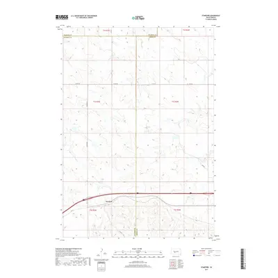
2017 Map of Stamford
USGS Topo · Published 2017About this map
Stamford sits at the southern edge of this West River landscape, positioned along the corridor of Hwy 16 and the Interstate 90 route. This modern survey illustrates the expansive section-line grid of the Great Plains, where long stretches of road like Stamford Rd and Church Rd define the local geography. The map captures the convergence of three counties—Haakon, Jackson, and Jones—marking a significant administrative junction in the South Dakota prairie.
Find a feature on this map
18 named features on this map. Tap any name to fly to it.
Don’t see what you’re looking for? This feature index may not catch every label — zoom into the map to look around manually.
Map Details
Editions of this 2017 Stamford Map
This is the sole edition of this map. No revisions or reprints were ever made.
Other maps of this area

1951 · Stamford SW
USGS Topo · 1:24,000

1951 · Capa
USGS Topo · 1:24,000

1951 · Stamford SE
USGS Topo · 1:24,000

1951 · Okaton SW
USGS Topo · 1:24,000

1954 · Midland
USGS Topo · 1:24,000

1954 · Midland SE
USGS Topo · 1:24,000

1954 · Pierre
USGS Topo · 1:250,000

1955 · Martin
USGS Topo · 1:250,000

1958 · Pierre
USGS Topo · 1:250,000

1958 · Martin
USGS Topo · 1:250,000