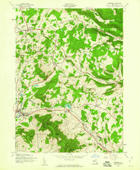
1945 Map of Stamford
USGS Topo · Published 1960About this map
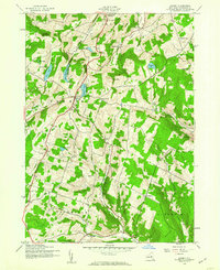
Stamford serves as a focal point in the southwest corner of this mid-century landscape, where the West Branch Delaware River begins its course near the shores of Utsayantha Lake. The map reveals a rural economy shaped by high-elevation terrain, with the New York Central railroad corridor cutting through the valley to serve South Gilboa Station. Genealogists will find a high density of small burial grounds scattered across the hills, including Evergreen Cem, Blenheim Hill Cem, and Champlin Cem, many of which sit near established settlements like Jefferson and South Jefferson. Notable peaks such as Utsayantha Mountain and Bald Mountain dominate the topography, while smaller hollows like Mine Kill Hollow and Darling Hollow Creek define the drainage patterns toward the northeast. The presence of School No 1 and various unnamed cemeteries suggests the historical footprint of earlier agricultural communities before the mid-1940s field check.
Find a feature on this map
47 named features on this map. Tap any name to fly to it.
Don’t see what you’re looking for? This feature index may not catch every label — zoom into the map to look around manually.
Map Details
Editions of this 1945 Stamford Map
4 editions found
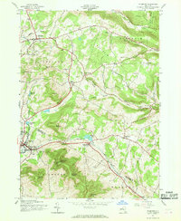
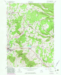

Other maps of this area

1898 · Schoharie
USGS Topo · 1:62,500

1900 · Schoharie
USGS Topo · 1:62,500

1901 · Gilboa
USGS Topo · 1:62,500

1903 · Gilboa
USGS Topo · 1:62,500

1904 · Richmondville
USGS Topo · 1:62,500

1904 · Hobart
USGS Topo · 1:62,500
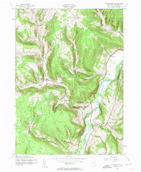
1943 · Breakabeen
USGS Topo · 1:24,000

1943 · Charlotteville
USGS Topo · 1:24,000
1943 · Summit
USGS Topo · 1:24,000

1945 · Summit
USGS Topo · 1:31,680