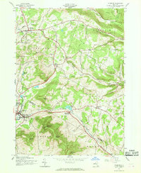
1945 Map of Stamford
USGS Topo · Published 1969About this map
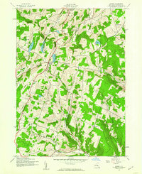
Stamford serves as a focal point at the southwestern edge of this survey, positioned where the Delaware River West Branch and Utsayantha Lake meet the steep slopes of Utsayantha Mountain. In the mid-1940s, the landscape is defined by its deep hollows and high ridges, with several kills such as West Kill and Shew Hollow Kill carving through the terrain. The presence of numerous family and community burial grounds, including Choate Cem, Ruliffson Cem, and Champlin Cem, provides a detailed record of the rural population distributed between the northern settlements of Jefferson and South Jefferson. The rail connection is evident at South Gilboa (Station), linking these upland communities to the broader region. Higher elevations are marked by landmarks like the Lookout Tower and Mount Jefferson, while the agricultural and residential patterns concentrate near the spring-fed waters and narrow valleys of the Moresville Range.
Find a feature on this map
52 named features on this map. Tap any name to fly to it.
Don’t see what you’re looking for? This feature index may not catch every label — zoom into the map to look around manually.
Map Details
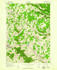
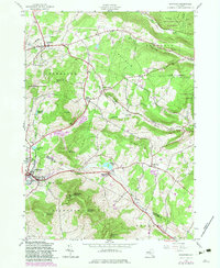
Editions of this 1945 Stamford Map
4 editions found

Other maps of this area

1898 · Schoharie
USGS Topo · 1:62,500

1900 · Schoharie
USGS Topo · 1:62,500

1901 · Gilboa
USGS Topo · 1:62,500

1903 · Gilboa
USGS Topo · 1:62,500

1904 · Richmondville
USGS Topo · 1:62,500

1904 · Hobart
USGS Topo · 1:62,500
1943 · Breakabeen
USGS Topo · 1:24,000

1943 · Charlotteville
USGS Topo · 1:24,000
1943 · Summit
USGS Topo · 1:24,000

1945 · Summit
USGS Topo · 1:31,680