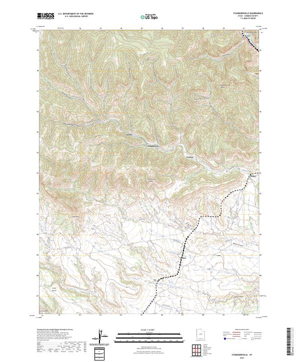
2023 Map of Standardville
USGS Topo · Published 2023About this map
Standardville sits within a complex network of narrow canyons and high ridges, anchoring a region defined by its industrial history and difficult geography. The settlement patterns follow the winding paths of Spring Canyon and its many branches, including Left Fork Spring Canyon and Robinson Gulch. These deep incisions into the landscape, such as Hardscrabble Canyon and Sowbelly Gulch, dictate the placement of towns like Latuda and Peerless, which are wedged between steep terrain and Ford Ridge.
Find a feature on this map
34 named features on this map. Tap any name to fly to it.
Don’t see what you’re looking for? This feature index may not catch every label — zoom into the map to look around manually.
Map Details
Editions of this 2023 Standardville Map
This is the sole edition of this map. No revisions or reprints were ever made.
Other maps of this area

1885 · Manti
USGS Topo · 1:250,000

1886 · Price River
USGS Topo · 1:250,000

1895 · Manti
USGS Topo · 1:250,000

1896 · Price River
USGS Topo · 1:250,000

1914 · Castle Gate
USGS Topo · 1:62,500

1916 · Castle Gate
USGS Topo · 1:62,500

1923 · Scofield
USGS Topo · 1:62,500

1925 · Scofield
USGS Topo · 1:62,500

1939 · Soldier Summit
USGS Topo · 1:62,500

1942 · Soldier Summit
USGS Topo · 1:62,500