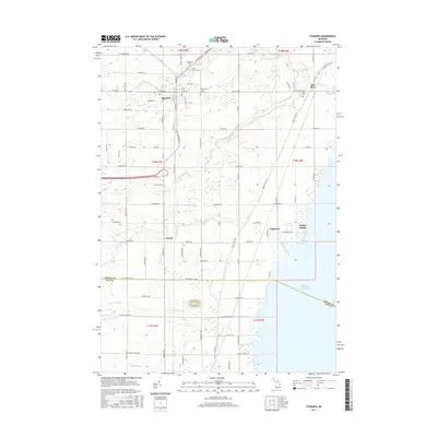
2017 Map of Standish
USGS Topo · Published 2017About this map
Standish serves as the focal point of this coastal Arenac County study, situated just inland from the western shores of Lake Huron. The landscape is defined by the convergence of several waterways, including the Middle Br Pine River and S Br Pine River, which flow eastward toward the bay. For those researching local heritage, the map identifies numerous small communities and landing points such as Worth, Saganing, and Whites Beach. Detailed burial grounds are prominent, including Woodmere Cem, Saint Johns Cem, and Resurrection of the Lord Cem near the town center. The southern portion of the sheet crosses the boundary into Bay County, marked by the courses of the Saganing River and White Feather Cr. The grid of local roads, such as Old M-10 and Huron Rd, reveals a transition from the urban blocks of the county seat to the drainage-rich agricultural lands and shoreline marshes to the east.
Find a feature on this map
93 named features on this map. Tap any name to fly to it.
Don’t see what you’re looking for? This feature index may not catch every label — zoom into the map to look around manually.
Map Details
Editions of this 2017 Standish Map
This is the sole edition of this map. No revisions or reprints were ever made.
Other maps of this area

1954 · Traverse City
USGS Topo · 1:250,000

1954 · Midland
USGS Topo · 1:250,000

1954 · Flint
USGS Topo · 1:250,000

1954 · Tawas City
USGS Topo · 1:250,000

1958 · Traverse City
USGS Topo · 1:250,000

1958 · Flint
USGS Topo · 1:250,000

1958 · Tawas City
USGS Topo · 1:250,000

1958 · Midland
USGS Topo · 1:250,000

1959 · Midland
USGS Topo · 1:250,000

1966 · Midland
USGS Topo · 1:250,000