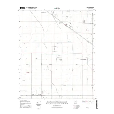
2014 Map of Stanfield
USGS Topo · Published 2014About this map
Casa Grande Valley serves as the backdrop for this agricultural and transport hub in the Sonoran desert. The settlement of Stanfield is situated at the intersection of Az-84 and the Union Pacific Railroad, which cuts diagonally across the landscape. The geography is defined by a network of drainage channels, most notably the meandering Santa Rosa Wash, which flows northward past Potters Field. To the northeast, the Ak-Chin Regional Airport stands near the small community of Bon. The rectilinear road grid, featuring local routes like W Cowtown Rd and W Barnes Rd, overlays a landscape deeply influenced by the seasonal flow of the Santa Cruz Wash and Greene Wash, reflecting the intersection of modern infrastructure and traditional desert hydrology.
Find a feature on this map
67 named features on this map. Tap any name to fly to it.
Don’t see what you’re looking for? This feature index may not catch every label — zoom into the map to look around manually.
Map Details
Editions of this 2014 Stanfield Map
This is the sole edition of this map. No revisions or reprints were ever made.
Other maps of this area

1913 · Maricopa
USGS Topo · 1:62,500

1914 · Gila Butte
USGS Topo · 1:62,500

1915 · Maricopa
USGS Topo · 1:62,500

1917 · Gila Butte
USGS Topo · 1:62,500

1922 · Casa Grande
USGS Topo · 1:62,500

1924 · Casa Grande
USGS Topo · 1:62,500

1946 · Antelope Peak
USGS Topo · 1:62,500

1948 · Antelope Peak
USGS Topo · 1:62,500

1952 · Gila Butte SE
USGS Topo · 1:24,000

1952 · Maricopa
USGS Topo · 1:24,000