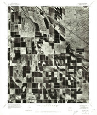
1971 Map of Stanfield
USGS Topo · Published 1972About this map
Stanfield serves as the focal point of this 1971 aerial perspective, showing the small agricultural settlement at a time of significant cultivation in Pinal County. The landscape is defined by an extensive grid of irrigated farm plots, their varied tones indicating different stages of growth or fallow ground during the July survey. Tracing through the northern portion of the quadrangle, the Santa Cruz Wash cuts a winding path through the desert terrain, its braided channel contrasting with the rigid geometry of the surrounding fields. This orthophotoquad captures the intersection of desert hydrology and modern irrigation, providing a precise record of land use and water management in the Arizona desert before later regional developments.
Find a feature on this map
2 named features on this map. Tap any name to fly to it.
Don’t see what you’re looking for? This feature index may not catch every label — zoom into the map to look around manually.
Map Details
Editions of this 1971 Stanfield Map
This is the sole edition of this map. No revisions or reprints were ever made.
Other maps of this area

1913 · Maricopa
USGS Topo · 1:62,500

1914 · Gila Butte
USGS Topo · 1:62,500

1915 · Maricopa
USGS Topo · 1:62,500

1917 · Gila Butte
USGS Topo · 1:62,500

1922 · Casa Grande
USGS Topo · 1:62,500

1924 · Casa Grande
USGS Topo · 1:62,500

1946 · Antelope Peak
USGS Topo · 1:62,500

1948 · Antelope Peak
USGS Topo · 1:62,500

1952 · Gila Butte SE
USGS Topo · 1:24,000

1952 · Maricopa
USGS Topo · 1:24,000