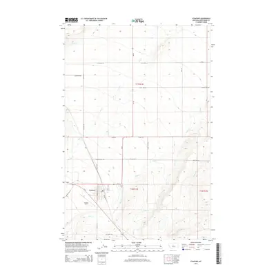
2014 Map of Stanford
USGS Topo · Published 2014About this map
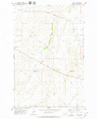
Stanford serves as the focal point of this Judith Basin County landscape, where the grain-growing heritage of the Montana plains is evident in the grid of rural roads and the presence of Railroad St. The town is flanked by essential community infrastructure, including the Stanford Airport to the southwest and the Stanford Cem just to the east. The surrounding terrain is defined by a network of seasonal watercourses, with Wolf Cr and Skull Cr carving through the prairie to meet near the settlement. The land division follows a strict township and range system, reflected in the straight-line paths of Elevator Rd and Sage Creek Rd, which connect remote farmsteads to the central hub. This 2014 survey captures the enduring layout of a Western agricultural center where the natural drainage of Coyote Cr and Meadow Cr still dictates the placement of roads and homesteads.
Find a feature on this map
30 named features on this map. Tap any name to fly to it.
Don’t see what you’re looking for? This feature index may not catch every label — zoom into the map to look around manually.
Map Details
Editions of this 2014 Stanford Map
This is the sole edition of this map. No revisions or reprints were ever made.
Other maps of this area

1890 · Fort Benton
USGS Topo · 1:250,000

1892 · Fort Benton
USGS Topo · 1:250,000

1897 · Fort Benton
USGS Topo · 1:250,000

1954 · Great Falls
USGS Topo · 1:250,000

1957 · Great Falls
USGS Topo · 1:250,000
1978 · Stanford NE
USGS Topo · 1:24,000

1978 · Leiberg Coulee
USGS Topo · 1:24,000
1978 · Benchland
USGS Topo · 1:24,000
1978 · Windham
USGS Topo · 1:24,000
1978 · Merino
USGS Topo · 1:24,000
Featured Places
- Stanford, MT
- J and M Trailer Court, MT
- Cotton Trailer Court, Stanford
- Judith Basin County, MT
- United States