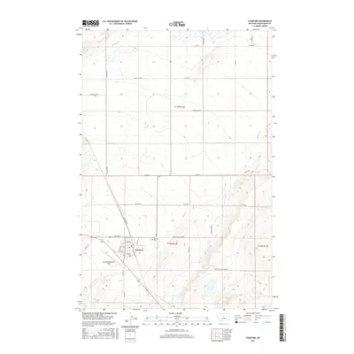
2017 Map of Stanford
USGS Topo · Published 2017About this map
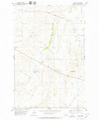
Stanford serves as the central hub of this Judith Basin County landscape, where the town's grid is anchored by Railroad St and the local Po. The surrounding terrain is defined by a dense network of watercourses, including Wolf Cr, Skull Cr, and Meadow Cr, which carve through the plains. Just south of the main settlement, the Stanford Cem and the Stanford/Biggerstaff Field provide local landmarks for researchers tracking family history or local aviation developments. The map illustrates a transition between the town's organized streets, such as 1st Ave N and 4th Ave S, and the rural expanse marked by long stretches of Lower Willow Creek Rd and N Seven Mile. The convergence of Coyote Cr and Dry Wolf Cr in the eastern portion of the quadrangle highlights the drainage patterns essential to this region's cattle and farming geography.
Find a feature on this map
39 named features on this map. Tap any name to fly to it.
Don’t see what you’re looking for? This feature index may not catch every label — zoom into the map to look around manually.
Map Details
Editions of this 2017 Stanford Map
This is the sole edition of this map. No revisions or reprints were ever made.
Other maps of this area

1890 · Fort Benton
USGS Topo · 1:250,000

1892 · Fort Benton
USGS Topo · 1:250,000

1897 · Fort Benton
USGS Topo · 1:250,000

1954 · Great Falls
USGS Topo · 1:250,000

1957 · Great Falls
USGS Topo · 1:250,000
1978 · Stanford NE
USGS Topo · 1:24,000

1978 · Leiberg Coulee
USGS Topo · 1:24,000
1978 · Benchland
USGS Topo · 1:24,000
1978 · Windham
USGS Topo · 1:24,000
1978 · Merino
USGS Topo · 1:24,000
Featured Places
- Stanford, MT
- J and M Trailer Court, MT
- Cotton Trailer Court, Stanford
- Judith Basin County, MT
- United States