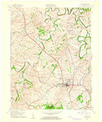
1961 Map of Stanford
USGS Topo · Published 1962About this map
The town of Stanford serves as the hub of this 1960s topographic study, situated at the intersection of early pioneer routes and mid-century infrastructure. The historic Wilderness Road and Wilderness Road Lane trace through the landscape, paralleled by the Louisville and Nashville railroad which connects the main settlement to Rowland. To the north, the winding course of the Dix River and Hanging Fork define the topography, while numerous family and community landmarks like the McCormack Ch, Hubble Sch, and Buffalo Spring Cem reflect the deep-rooted local history of Lincoln County.
Find a feature on this map
41 named features on this map. Tap any name to fly to it.
Don’t see what you’re looking for? This feature index may not catch every label — zoom into the map to look around manually.
Map Details
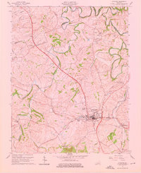
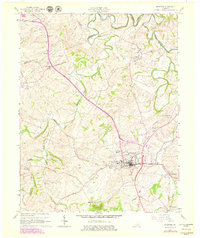
Editions of this 1961 Stanford Map
3 editions found
Other maps of this area

1905 · Harrodsburg
USGS Topo · 1:125,000

1950 · Bryantsville
USGS Topo · 1:24,000

1952 · Halls Gap
USGS Topo · 1:24,000

1952 · Crab Orchard
USGS Topo · 1:24,000

1952 · Buckeye
USGS Topo · 1:24,000

1952 · Hustonville
USGS Topo · 1:24,000

1952 · Danville
USGS Topo · 1:24,000

1952 · Lancaster
USGS Topo · 1:24,000

1952 · Bryantsville
USGS Topo · 1:24,000

1952 · Stanford
USGS Topo · 1:24,000