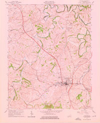
1961 Map of Stanford
USGS Topo · Published 1976About this map
The historic Wilderness Road cuts a prominent diagonal across the landscape of Lincoln County, anchoring the town of Stanford at its intersection with the Louisville and Nashville railroad. This 1961 revision captures the area's transition between agricultural tradition and post-war development, visible in the presence of the Drive-in Theater and the Danville Memorial Gardens. The settlement pattern follows the meandering Hanging Fork and Dix River, with small communities like Hubble and Rowland serving as local hubs. Genealogists will find significant value in the detailed documentation of family and community burial grounds, including the Buffalo Spring Cem, Blackerby Cem, and Sutton Cem. The topography is defined by the limestone-rich Kentucky Bluegrass region, punctuated by Buffalo Spring and numerous small branches like Knoblick Creek and Peyton Creek.
Find a feature on this map
35 named features on this map. Tap any name to fly to it.
Don’t see what you’re looking for? This feature index may not catch every label — zoom into the map to look around manually.
Map Details
Editions of this 1961 Stanford Map
3 editions found
Other maps of this area

1905 · Harrodsburg
USGS Topo · 1:125,000

1950 · Bryantsville
USGS Topo · 1:24,000

1952 · Halls Gap
USGS Topo · 1:24,000

1952 · Crab Orchard
USGS Topo · 1:24,000

1952 · Buckeye
USGS Topo · 1:24,000

1952 · Hustonville
USGS Topo · 1:24,000

1952 · Danville
USGS Topo · 1:24,000

1952 · Lancaster
USGS Topo · 1:24,000

1952 · Bryantsville
USGS Topo · 1:24,000

1952 · Stanford
USGS Topo · 1:24,000