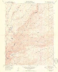
1949 Map of Stanislaus
USGS Topo · Published 1949About this map
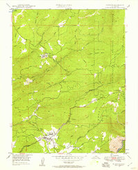
Stanislaus National Forest terrain dominates this 1940s topography, showing a landscape defined by the deep canyons of the Stanislaus River and its multiple forks. Significant industrial and utility infrastructure is evident, including the Utica Ditch system, a prominent Powerhouse, and a Tunnel cutting through the ridges. Small mountain settlements such as Avery and Hathaway Pines are located along the Ebbetts Pass Highway, providing a look at the early residential and commercial footprint in this part of Calaveras and Tuolumne Counties.
Find a feature on this map
40 named features on this map. Tap any name to fly to it.
Don’t see what you’re looking for? This feature index may not catch every label — zoom into the map to look around manually.
Map Details
Editions of this 1949 Stanislaus Map
2 editions found
Other maps of this area

1891 · Big Trees
USGS Topo · 1:125,000

1894 · Big Trees
USGS Topo · 1:125,000

1897 · Big Trees
USGS Topo · 1:125,000

1901 · Big Trees
USGS Topo · 1:125,000

1947 · Sacramento
USGS Topo · 1:250,000

1948 · Sacramento
USGS Topo · 1:250,000

1948 · Columbia
USGS Topo · 1:62,500
1948 · Columbia SE
USGS Topo · 1:24,000
1948 · Columbia
USGS Topo · 1:24,000
1948 · Murphys
USGS Topo · 1:24,000