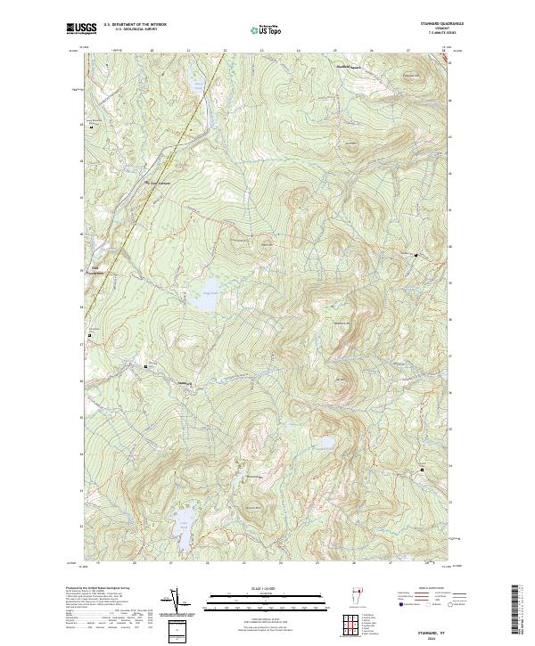
2024 Map of Stannard
USGS Topo · Published 2024About this map
Wheelock Mtn and Stannard Mtn anchor this high-elevation landscape along the border of Orleans and Caledonia counties. The settlement of Stannard sits at the heart of a network of rural routes like Stannard Mountain Rd and Olney Rd, connecting dispersed homesteads and local landmarks. To the northwest, the Green Mountain Monastery occupies a quiet position near Paine Brook, while the village of East Greensboro marks the western edge of the quadrangle.
Find a feature on this map
89 named features on this map. Tap any name to fly to it.
Don’t see what you’re looking for? This feature index may not catch every label — zoom into the map to look around manually.
Map Details
Editions of this 2024 Stannard Map
This is the sole edition of this map. No revisions or reprints were ever made.
Other maps of this area

1928 · Hardwick
USGS Topo · 1:62,500

1934 · Hardwick
USGS Topo · 1:48,000

1935 · Lyndonville
USGS Topo · 1:48,000

1938 · Hardwick
USGS Topo · 1:62,500

1938 · St. Johnsbury
USGS Topo · 1:48,000

1939 · Lyndonville
USGS Topo · 1:62,500

1939 · Plainfield
USGS Topo · 1:48,000

1940 · Plainfield
USGS Topo · 1:62,500

1943 · Plainfield
USGS Topo · 1:62,500

1943 · St. Johnsbury
USGS Topo · 1:62,500