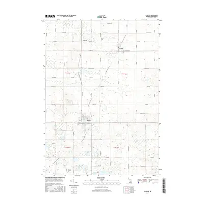
2017 Map of Stanton
USGS Topo · Published 2017About this map
Stanton serves as a central hub in this part of Montcalm County, situated at the intersection of local routes and the modern Fred Meijer Heartland Trail. The landscape is defined by its glacial heritage, characterized by numerous small bodies of water such as Colby Lake, Hemmingway Lake, and Hardley Lake that dot the countryside. Educational and civic foundations are evident through the presence of Montcalm Community Coll and several established burial grounds, including Forest Hill Cem and Palmer Cem. Smaller village centers like McBride and Westville maintain their distinct footprints, connected by a grid of named rural roads like Carlson Rd and Kendaville Rd. The area demonstrates a transition from traditional agricultural town centers to a region supporting both higher education and recreational trail networks.
Find a feature on this map
89 named features on this map. Tap any name to fly to it.
Don’t see what you’re looking for? This feature index may not catch every label — zoom into the map to look around manually.
Map Details
Editions of this 2017 Stanton Map
This is the sole edition of this map. No revisions or reprints were ever made.
Other maps of this area

1954 · Midland
USGS Topo · 1:250,000

1958 · Midland
USGS Topo · 1:250,000

1959 · Midland
USGS Topo · 1:250,000

1964 · Edmore
USGS Topo · 1:24,000

1964 · Six Lakes
USGS Topo · 1:24,000

1964 · Langston
USGS Topo · 1:24,000

1964 · Stanton
USGS Topo · 1:24,000

1965 · Vestaburg
USGS Topo · 1:24,000

1965 · Crystal
USGS Topo · 1:24,000

1966 · Midland
USGS Topo · 1:250,000