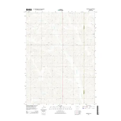
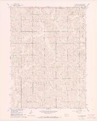
2014 Map of Stanton SE
USGS Topo · Published 2014About this map
The rolling agricultural landscape of eastern Nebraska is meticulously detailed in this 2014 study of the border between Stanton Co and Cuming Co. The terrain is defined by the winding course of the E Fork Maple Cr, which carves through the central portion of the area, while the eastern edge is marked by the headwaters of Pebble Cr and its northern branch. This map documents a strictly grid-based rural infrastructure where local life is anchored by family landmarks and small-scale water management, such as the Kucera Reservoir in the southwest. A notable point of historical and genealogical interest is the Saint Peters Cem located along the eastern county line, serving as a primary cultural landmark for the surrounding farming community. The map provides a clear picture of the modern road network, where numbered avenues like 574 Ave intersect with lettered and numbered rural roads to maintain the region's agricultural layout.
Find a feature on this map
30 named features on this map. Tap any name to fly to it.
Don’t see what you’re looking for? This feature index may not catch every label — zoom into the map to look around manually.
Map Details
Editions of this 2014 Stanton SE Map
This is the sole edition of this map. No revisions or reprints were ever made.
Other maps of this area

1955 · Fremont
USGS Topo · 1:250,000

1957 · Fremont
USGS Topo · 1:250,000

1958 · Fremont
USGS Topo · 1:250,000

1963 · Wisner
USGS Topo · 1:24,000
1963 · Stanton NE
USGS Topo · 1:24,000
1963 · Stanton
USGS Topo · 1:24,000

1966 · Aloys
USGS Topo · 1:24,000

1966 · Clarkson
USGS Topo · 1:24,000
1966 · Stanton SE
USGS Topo · 1:24,000
1966 · Stanton SW
USGS Topo · 1:24,000