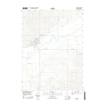
2014 Map of Stanton
USGS Topo · Published 2014About this map
The Stanton townsite serves as the central hub of this Nebraska landscape, situated near the confluence of several vital waterways including Maskenthine Cr and the Elkhorn River. The town's grid is well-defined by local thoroughfares such as Veterans Ave and Nutmeg St, surrounded by the agricultural sections of the Great Plains. For local historians, the presence of three distinct burial grounds—the Independent Order of Odd Fellows Cem, Zander Cem, and Koch Cem—provides significant genealogical reference points north of the town center. The surrounding terrain is heavily influenced by water management and drainage, featuring the Maskenthine Reservoir to the northwest and Sand Creek Reservoir 2 to the south, which along with Butterfly Cr and Union Cr, illustrate the complex hydrology of the region.
Find a feature on this map
54 named features on this map. Tap any name to fly to it.
Don’t see what you’re looking for? This feature index may not catch every label — zoom into the map to look around manually.
Map Details
Editions of this 2014 Stanton Map
This is the sole edition of this map. No revisions or reprints were ever made.
Other maps of this area

1955 · Sioux City
USGS Topo · 1:250,000

1955 · Fremont
USGS Topo · 1:250,000

1957 · Fremont
USGS Topo · 1:250,000

1958 · Sioux City
USGS Topo · 1:250,000

1958 · Fremont
USGS Topo · 1:250,000

1959 · Sioux City
USGS Topo · 1:250,000

1963 · Hoskins
USGS Topo · 1:24,000

1963 · Madison SE
USGS Topo · 1:24,000

1963 · Pilger
USGS Topo · 1:24,000

1963 · Wayne SW
USGS Topo · 1:24,000