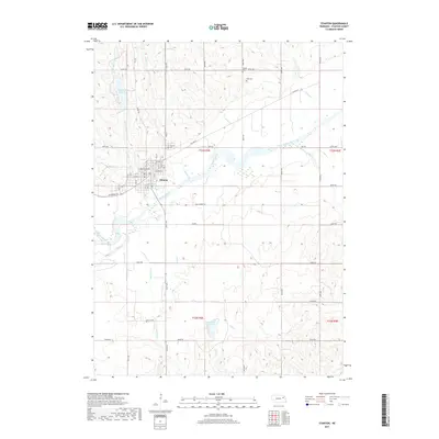
2017 Map of Stanton
USGS Topo · Published 2017About this map
The Elkhorn River carves a broad valley through the center of this Nebraska landscape, anchoring the city of Stanton. The town is organized around a grid of streets such as Jackpine St and Veterans Ave, serving as a central hub for the surrounding agricultural sections. To the north, the Maskenthine Reservoir and Maskenthine Creek provide significant water management and recreational geography, while smaller waterways like Indian Creek and Sand Creek drain the undulating hills into the main river channel.
Find a feature on this map
39 named features on this map. Tap any name to fly to it.
Don’t see what you’re looking for? This feature index may not catch every label — zoom into the map to look around manually.
Map Details
Editions of this 2017 Stanton Map
This is the sole edition of this map. No revisions or reprints were ever made.
Other maps of this area

1955 · Sioux City
USGS Topo · 1:250,000

1955 · Fremont
USGS Topo · 1:250,000

1957 · Fremont
USGS Topo · 1:250,000

1958 · Sioux City
USGS Topo · 1:250,000

1958 · Fremont
USGS Topo · 1:250,000

1959 · Sioux City
USGS Topo · 1:250,000

1963 · Hoskins
USGS Topo · 1:24,000

1963 · Madison SE
USGS Topo · 1:24,000

1963 · Pilger
USGS Topo · 1:24,000

1963 · Wayne SW
USGS Topo · 1:24,000