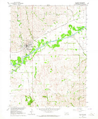
1963 Map of Stanton
USGS Topo · Published 1964About this map
Stanton serves as the central hub of this Nebraska landscape, situated north of the meandering Elkhorn River. In the early 1960s, the town's footprint was characterized by its proximity to the Chicago and North Western railroad, which arcs through the valley. The map reveals a deeply rooted rural community, indicated by family and community landmarks such as Zander Cem and Koch Cem to the north, and the IOOF Cem just west of the main settlement.
Find a feature on this map
23 named features on this map. Tap any name to fly to it.
Don’t see what you’re looking for? This feature index may not catch every label — zoom into the map to look around manually.
Map Details
Editions of this 1963 Stanton Map
2 editions found
Other maps of this area

1955 · Sioux City
USGS Topo · 1:250,000

1955 · Fremont
USGS Topo · 1:250,000

1957 · Fremont
USGS Topo · 1:250,000

1958 · Sioux City
USGS Topo · 1:250,000

1958 · Fremont
USGS Topo · 1:250,000

1959 · Sioux City
USGS Topo · 1:250,000

1963 · Hoskins
USGS Topo · 1:24,000

1963 · Madison SE
USGS Topo · 1:24,000

1963 · Pilger
USGS Topo · 1:24,000

1963 · Wayne SW
USGS Topo · 1:24,000