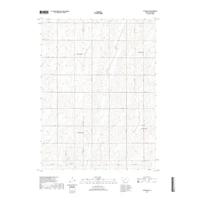
2018 Map of Stanton SW
USGS Topo · Published 2018About this map
The Tarkio River and its accompanying forks dominate this agricultural landscape in Page County. The drainage network, featuring the W Tarkio Cr and E Tarkio Cr, creates a rhythmic pattern of ridges and valleys across the township. This modern survey illustrates the persistent rural infrastructure of southwest Iowa, where a strict section-line road grid—including Ironwood Ave and Lumber Ave—defines the movement of people and commerce. Genealogical researchers will find two significant burial sites preserved within this grid: Baker Cem located near the center of the township and Summit Cem situated in the southeastern corner. The map also distinguishes between maintained thoroughfares like Co Hwy M56 and more primitive tracks, such as the designated Level B Rd, reflecting the varied accessibility of this farming country.
Find a feature on this map
25 named features on this map. Tap any name to fly to it.
Don’t see what you’re looking for? This feature index may not catch every label — zoom into the map to look around manually.
Map Details
Editions of this 2018 Stanton SW Map
This is the sole edition of this map. No revisions or reprints were ever made.
Other maps of this area

1939 · Farragut
USGS Topo · 1:62,500

1940 · Farragut
USGS Topo · 1:62,500

1940 · Coin
USGS Topo · 1:62,500

1943 · Coin
USGS Topo · 1:62,500

1955 · Nebraska City
USGS Topo · 1:250,000

1957 · Nebraska City
USGS Topo · 1:250,000

1958 · Nebraska City
USGS Topo · 1:250,000

1978 · Stanton
USGS Topo · 1:24,000

1978 · Shenandoah East
USGS Topo · 1:24,000

1978 · Stanton SW
USGS Topo · 1:24,000