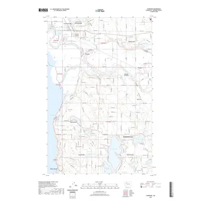
2020 Map of Stanwood
USGS Topo · Published 2020About this map
The Stillaguamish River dominates this Snohomish County landscape, winding through a complex network of waterways including Irvine Slough, Hat Slough, and Jorgenson Slough. The twin settlements of Stanwood and East Stanwood serve as northern anchors, while the southern reaches feature prominent lake-side and coastal communities. Local history is deeply rooted in the area's spiritual and burial sites, notably Our Saviour's Lutheran Church Cem and Anderson Cem near the riverbanks.
Find a feature on this map
85 named features on this map. Tap any name to fly to it.
Don’t see what you’re looking for? This feature index may not catch every label — zoom into the map to look around manually.
Map Details
Editions of this 2020 Stanwood Map
This is the sole edition of this map. No revisions or reprints were ever made.
Other maps of this area

1911 · Mount Vernon
USGS Topo · 1:125,000

1940 · Mt Vernon
USGS Topo · 1:62,500

1941 · Marysville
USGS Topo · 1:62,500

1943 · Marysville
USGS Topo · 1:62,500

1943 · Mt Vernon
USGS Topo · 1:62,500

1943 · Stanwood
USGS Topo · 1:62,500

1944 · Clear Lake
USGS Topo · 1:62,500

1956 · Tulalip
USGS Topo · 1:24,000

1956 · Arlington West
USGS Topo · 1:24,000
1956 · Stanwood
USGS Topo · 1:24,000