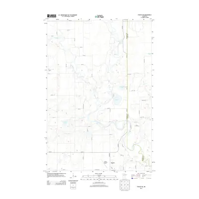
2013 Map of Staples NE
USGS Topo · Published 2013About this map
The Crow Wing River snakes through this Central Minnesota landscape, where the confluence of the Leaf River and Partridge River defines the local drainage patterns. Located at the southern edge of the sheet, the community of Staples serves as the regional hub, situated near the Staples Municipal Airport and the winding course of Hayden Cr. The area is characterized by numerous glacial lakes, including Lovejoy Lake, Radabaugh Lake, and Simon Lake, which punctuate the rural terrain along the Wadena and Cass County line.
Find a feature on this map
57 named features on this map. Tap any name to fly to it.
Don’t see what you’re looking for? This feature index may not catch every label — zoom into the map to look around manually.
Map Details
Editions of this 2013 Staples NE Map
This is the sole edition of this map. No revisions or reprints were ever made.
Other maps of this area

1919 · Leader
USGS Topo · 1:62,500

1953 · Brainerd
USGS Topo · 1:250,000

1957 · Brainerd
USGS Topo · 1:250,000

1958 · Brainerd
USGS Topo · 1:250,000

1963 · Motley
USGS Topo · 1:24,000

1965 · Brainerd
USGS Topo · 1:250,000

1966 · Staples NE
USGS Topo · 1:24,000
1966 · Motley NW
USGS Topo · 1:24,000

1966 · Staples
USGS Topo · 1:24,000

1966 · Aldrich North
USGS Topo · 1:24,000