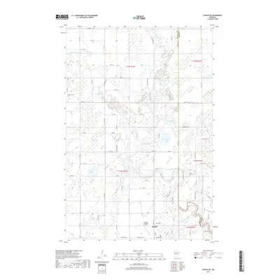
2019 Map of Staples NE
USGS Topo · Published 2019About this map
The confluence of the Leaf River, Partridge River, and the winding Crow Wing River dictates the landscape of this region on the border of Wadena and Cass counties. The northern reaches of Staples occupy the southern margin of the map, where the Staples Municipal Airport and a grid of residential streets like Prairie Ave W and Spruce Dr contrast with the wetland-dense terrain to the north. This area reflects a classic central Minnesota transition from a growing rail-and-timber town into a vast network of marshes, creeks, and small lakes.
Find a feature on this map
81 named features on this map. Tap any name to fly to it.
Don’t see what you’re looking for? This feature index may not catch every label — zoom into the map to look around manually.
Map Details
Editions of this 2019 Staples NE Map
This is the sole edition of this map. No revisions or reprints were ever made.
Other maps of this area

1919 · Leader
USGS Topo · 1:62,500

1953 · Brainerd
USGS Topo · 1:250,000

1957 · Brainerd
USGS Topo · 1:250,000

1958 · Brainerd
USGS Topo · 1:250,000

1963 · Motley
USGS Topo · 1:24,000

1965 · Brainerd
USGS Topo · 1:250,000

1966 · Staples NE
USGS Topo · 1:24,000
1966 · Motley NW
USGS Topo · 1:24,000

1966 · Staples
USGS Topo · 1:24,000

1966 · Aldrich North
USGS Topo · 1:24,000