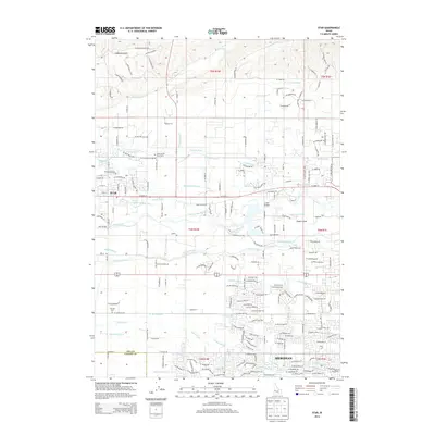
2013 Map of Star
USGS Topo · Published 2013About this map
Boise River hydrology and an intricate network of irrigation systems dominate this landscape between Star and Meridian. The map reveals a complex water management history through numerous named channels like the Middleton Mill Canal, Phyllis Canal, and Farmers Union Canal that distribute water across the valley. Centrally located, Eagle Island sits as a significant landform partitioned by the river and various sloughs, including North Slough and Phyllis Slough. This 2013 survey provides a clear view of the growing suburban footprint encroaching on the agricultural heritage of Ada County. Genealogists may find value in the location of the Home of the Peace Cem and Fairview Cem, while the Eagle Hatchery and Linder Bridge serve as modern landmarks within this shifting landscape of water and development.
Find a feature on this map
203 named features on this map. Tap any name to fly to it.
Don’t see what you’re looking for? This feature index may not catch every label — zoom into the map to look around manually.
Map Details
Editions of this 2013 Star Map
This is the sole edition of this map. No revisions or reprints were ever made.
Other maps of this area

1892 · Boise
USGS Topo · 1:125,000

1897 · Boise
USGS Topo · 1:125,000

1898 · Nampa
USGS Topo · 1:125,000

1953 · Eagle
USGS Topo · 1:24,000

1953 · Cloverdale
USGS Topo · 1:24,000

1953 · Meridian
USGS Topo · 1:24,000

1953 · Star
USGS Topo · 1:24,000

1953 · Montour
USGS Topo · 1:62,500

1955 · Boise
USGS Topo · 1:250,000

1958 · Boise
USGS Topo · 1:250,000