2024 Map of Star
USGS Topo · Published 2024About this map
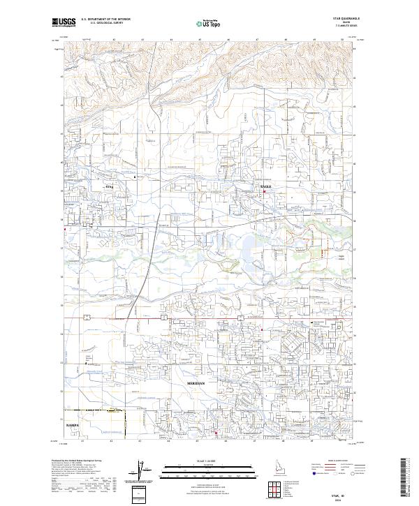
The Boise River forms a central hydrologic corridor between the burgeoning communities of Star, Eagle, and Meridian in this recent study of Ada and Canyon counties. The landscape is defined by an intricate network of irrigation infrastructure dating back to early agricultural settlement, including the Farmers Union Canal, Middleton Mill Canal, and Phyllis Canal. These waterways dictate the local geography, weaving between established sites like the Star Cem and newer developments. Of particular interest is Eagle Island, situated between river forks and home to the Eagle Fish Health Laboratory. Genealogists may find value in the documentation of the Lower Fairview Cem and the Holy Apostles Catholic Church Columbarium, which serve as anchors for local family histories amid the rapidly changing residential footprint of the Treasure Valley.
Find a feature on this map
230 named features on this map. Tap any name to fly to it.
Don’t see what you’re looking for? This feature index may not catch every label — zoom into the map to look around manually.
Map Details
Editions of this 2024 Star Map
This is the sole edition of this map. No revisions or reprints were ever made.
Historical Maps of Meridian Through Time
2 maps found