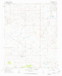
1961 Map of Star Lake
USGS Topo · Published 1963About this map
The Continental Divide winds through this high-desert landscape in McKinley and Sandoval counties, defining a region where water and energy infrastructure converge. In the early 1960s, the Star Lake Trading Post served as a central hub for the surrounding community, located near a Mission and a localized Landing Strip. The presence of the Star Lake Pumping Station and various Pipelines indicates the area's importance as a mid-century energy corridor. Natural features like Pot Mesa and the escarpment of Ceja Del Raton dominate the topography, interspersed with seasonal water sources such as Franciscan Lake and Mosquito Tank. This survey captures the sparse but critical settlement patterns of the Navajo Nation boundary lands, where cattle tanks and trading posts supported a rural economy long before modern expansion changed the face of the New Mexico interior.
Find a feature on this map
24 named features on this map. Tap any name to fly to it.
Don’t see what you’re looking for? This feature index may not catch every label — zoom into the map to look around manually.
Map Details
Editions of this 1961 Star Lake Map
2 editions found
Other maps of this area

1883 · Mt. Taylor
USGS Topo · 1:250,000

1886 · Mt. Taylor
USGS Topo · 1:250,000

1889 · Largo
USGS Topo · 1:250,000

1892 · Mt. Taylor
USGS Topo · 1:250,000

1895 · Largo
USGS Topo · 1:250,000

1899 · Mt. Taylor
USGS Topo · 1:250,000

1954 · Aztec
USGS Topo · 1:250,000

1958 · Aztec
USGS Topo · 1:250,000

1958 · Albuquerque
USGS Topo · 1:250,000

1960 · Pueblo Alto Trading Post
USGS Topo · 1:24,000