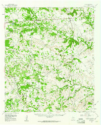
1959 Map of Star
USGS Topo · Published 1961About this map
Star Mountain and Bread Tray Mountain rise over the Texas hill country where Mills, Hamilton, and Lampasas counties meet. At the close of the 1950s, the rural community of Star sits at a crossroads while Center City and Moline anchor the central hills. The landscape is defined by a dense network of water gaps and hollows, such as Payne Gap and Pigtoot Hollow, which channel local movement through the winding drainage of Bennett Creek and Simms Creek.
Find a feature on this map
50 named features on this map. Tap any name to fly to it.
Don’t see what you’re looking for? This feature index may not catch every label — zoom into the map to look around manually.
Map Details
Editions of this 1959 Star Map
This is the sole edition of this map. No revisions or reprints were ever made.
Other maps of this area

1885 · San Saba
USGS Topo · 1:125,000

1887 · Lampasas
USGS Topo · 1:125,000

1888 · Hamilton
USGS Topo · 1:125,000

1889 · Brownwood
USGS Topo · 1:125,000

1894 · Hamilton
USGS Topo · 1:125,000

1894 · Lampasas
USGS Topo · 1:125,000

1894 · Brownwood
USGS Topo · 1:125,000

1894 · San Saba
USGS Topo · 1:125,000

1925 · San Saba 4-a
USGS Topo · 1:48,000

1925 · San Saba 1-d
USGS Topo · 1:48,000